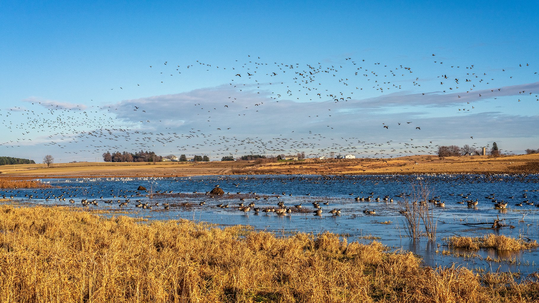
Goose Pond is a prairie pothole freshwater marsh, a rarity among wetland types in Wisconsin. There are 64 million acres of prairie potholes in the U.S. with most located in Montana, North and South Dakota, Minnesota and Iowa and the Canadian Provinces of Alberta, Saskatchewan, and Manitoba.
Named for rock deposits studied in Wisconsin, the Wisconsin Glaciation Episode was the last climate cooling and glacier expansion in North America. The period began between 100,000 and 75,000 years ago and ended its northern migration about 11,000 years ago.
As the glacier receded, large chunks of ice broke away from the one to two-mile-thick ice shield and remained, compacting the soil into a shallow depression and melting in place, filling the depression with water. These shallow depressions are referred to as potholes.
Abundance of waterfowl at Goose Pond Sanctuary during a normal year (photo by Monica Hall).
The bed of Goose Pond contains three feet of topsoil mostly from over 150 years of agricultural runoff over 20 feet of blue clay that is impenetrable to water. Because potholes are not associated with streams and are above the water table, they experience wet and dry cycles. Droughts, about once every 10 years are actually beneficial by allowing sediment to settle, providing the seeds of emergent wetland plants an opportunity to germinate, and to eliminate fathead minnows that eat frog and salamander eggs and invertebrates that ducklings prefer.
Jim Shurts, Curt Caslavka, Chuck Pils, and Susan Slapnick checking out the dry pond in 2012 (Madison Audubon photo).
So, what causes a lack of water in Goose Pond? This question was repeated in the major droughts of 1988 and 2012. The dry weather that caused Goose Pond to go dry actually began in 2021 when we received less than 13.5 inches of normal precipitation. Other factors that reduce water levels are above normal temperatures that increase evaporation, lack of deep snow that melts rapidly with frozen ground, and lack of large precipitation events. These four conditions caused the pond to go completely dry in late July. Water levels were very low in early November following 1.75 inches of rain in two days. However, when shallow water returns so do the waterfowl.
Prairie potholes are often under-appreciated but many are valuable rechargers of groundwater and are important to wildlife and people. Potholes can hold back water in times of high water levels and reduce downstream flooding.
High water years we remember are 1993 and the record high water year of 2019 when the pond was seven feet deep and water covered parts of Kampen and Goose Pond Roads.
High water levels at Goose Pond Sanctuary in March 2019 (photo by Josh Media).
Water covers part of the roads near the sanctuary (photo by Josh Media).
Climate change also impacts Goose Pond water levels. One example is forecasts of larger rain events including more 100 year floods that will increase water levels.
Concerns of people who flock to Goose Pond to view waterfowl migrations in spring and fall are genuine. We are accustomed to driving to the pond to spend time viewing waterfowl migrations and are alarmed to see that the pond has gone dry. When finding the pond dry, the birds move to wetlands that still contain water. These larger wetlands and lakes hold water throughout the year and do not experience wet and dry cycles.
A flock of American Golden Plovers land in Goose Pond’s shallow waters in mid-October 2022. Photo by Arlene Koziol
We conduct wildlife surveys including breeding waterfowl pair counts, the DNR frog and toad survey, and damselflies and dragonflies to see how their populations change with changes to Goose Pond water levels.
We are looking forward to a return of normal water levels and will be recording future changes to the pond and wildlife.
written by Susan Foote-Martin and Mark Martin, Goose Pond Sanctuary resident managers
Cover photo by Madison Audubon. Goose Pond on October 26, 2022


